From Farm to Profession: Why Rural Surveying Is a Natural Fit for Young People in Agriculture
By Rhona Booth, Partner
For many young people growing up on farms, choosing a career can feel like a choice between staying in agriculture or leaving it behind. But rural surveying offers a path that keeps one foot firmly in the countryside while opening the door to a rewarding professional future.
Bell Ingram’s Graduate Surveyor programme is designed to help young people turn their understanding of rural business into a long-term career that helps shape the rural economy and landscape around them.
From utilities, infrastructure and renewable energy developments to farm succession planning and diversification schemes, surveying covers a variety of exciting projects and graduates quickly discover that no two days are the same.
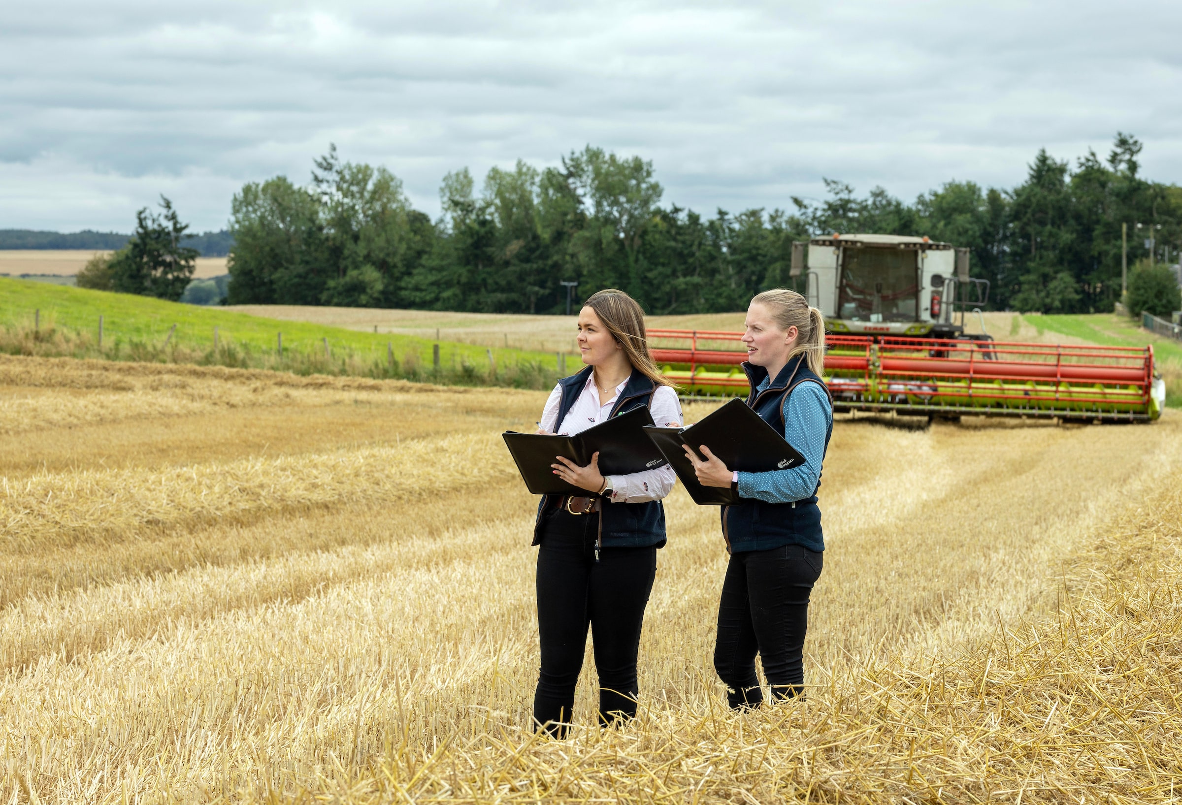
At Bell Ingram, our graduate surveyors play an active role within their teams from the outset. Their work includes overseeing agricultural and residential property and estate management for a wide range of clients, delivering land and property advice on major utilities, infrastructure and renewable energy schemes, and assisting with projects from initial planning through to completion.
The role requires initiative, organisation and a proactive approach to meeting client deadlines and objectives – qualities that many people from farming backgrounds already possess.
That agricultural experience can be a significant advantage. Understanding how farms operate day to day, the financial pressures facing agricultural businesses, and the realities of managing land provides valuable context when advising rural clients. Being able to combine professional knowledge with first-hand experience allows surveyors to see challenges from the client’s or landowners perspective and provide practical, grounded advice.
This connection between farming and professional services is reflected in the work graduates undertake during their first year. Typically, they gain hands-on experience across several areas, working alongside experienced surveyors on valuations, mapping, access rights, land sales and general estate management. This breadth of exposure helps graduates develop both technical knowledge and confidence in dealing with clients and rural businesses.
There are several routes into the Bell Ingram Graduate Surveyor programme. Ideally, applicants will have a degree accredited by the Royal Institution of Chartered Surveyors (RICS). However, the firm also supports candidates who are willing to complete relevant postgraduate study to gain the necessary qualifications. Bell Ingram has supported graduates through further education to enable them to sit their Assessment of Professional Competence (APC), ensuring that those with the right attitude and rural understanding are not excluded by their academic pathway.
Professional accreditation is a central part of the graduate journey. Graduates work towards becoming Chartered Surveyors through the RICS APC, supported by a structured training programme. This includes internal and external continued professional development events, graduate training days, commercial and professional skills training, and guidance from a dedicated RICS supervisor and counsellor.
For those coming directly from hands-on farming, the transition into a professional services role can seem daunting. The graduate programme is designed to make that transition easier. By shadowing experienced professionals – many of whom continue to balance their own rural businesses alongside their surveying careers – graduates gain insight into how agricultural life and professional work can complement one another. This exposure helps build confidence and demonstrates that a career in surveying does not mean leaving farming behind.
The long-term career prospects within the profession are significant. Bell Ingram places strong emphasis on internal development and progression, with many former graduates moving into senior roles within the firm. Mark Mitchell, Managing Partner at Bell Ingram, is one such example. He began his career with the company as a Graduate Land Agent and has progressed to lead the business today, a journey that highlights the opportunities available to those entering the profession.
Other graduates from farming backgrounds have advanced to Associate and Senior Associate positions and now play an active role in mentoring and training new recruits. Their progression reflects both the value of agricultural experience and the strength of the graduate programme in developing future rural professionals.
For young people considering their future, rural surveying offers a way to stay connected to the land while building a professional career with variety, responsibility and purpose. If you love rural life but want to broaden your horizons, becoming a rural surveyor may be less of a departure from farming than it first appears, and more of a natural next step.
For more information on Bell Ingram’s Graduate Programme visit bellingram.co.uk/early-careers