Bringing Maps to Life

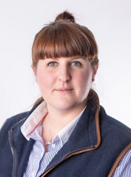
By Mhairi Walker, GIS Technician

The world of GIS Mapping is changing and 3D visualisation is enhancing 2D capabilities – taking clients into another dimension.

Working alongside colleagues in forestry, Bell Ingram’s GIS team have begun work on 3D visualisations for new woodland creation schemes.

Over the years, GIS has made a significant impact in showcasing mapping as an essential tool to interpret spatial data. 3D GIS visualisation depict objects in greater detail by adding a third dimension that allows for real scale representation of real-life objects.

3D visualisation is nothing new, but traditionally these models would be laid out in physical form. Nowadays, with the help of more sophisticated technology, such as our ArcGIS based system, we can not only envisage and evaluate in one place, but also manage all the necessary facts and figures.

Visualising in 3D is becoming increasingly popular in the forestry sector because areas of woodland can be accurately interpreted and, crucially, visualised over their life span. Incorporating our 3D technology into GIS customises the whole experience for clients, making it more personal and enabling greater detail and visualisation.

This is particularly helpful when applying for grants and engaging with public consultations, as regulating bodies and neighbours can really get a sense for the impact the proposed forest will have on the landscape, helping to strengthen the public consultation process.

On top of this, we can accurately depict the forest over its entire life span, for example, showing the growth rate over a ten and 20 year period. There is also the ability to account for a mix of species and death rate, which is crucial when characterising new commercial and even non-commercial woodland schemes for the duration of their existence on the landscape.

This ability to accurately show the change on a landscape over time in 3D, clearly has benefits that reach beyond the forestry industry. Bell Ingram’s utilities department will also be benefit from the ability to contextualise renewable developments and infrastructure projects for all stakeholders.

3D visualisation is a natural evolution for GIS and the possibilities are truly endless. Introducing 3D to forestry and rural land management is an exciting development for the firm and I am delighted to be able to champion this progress.

If you are interested in 3D GIS visualisation, get in touch with our GIS technician, Mhairi Walker on mhairi.walker@bellingram.co.uk or 01738 621121 to discuss your needs. For more information on our GIS Mapping service visit bellingram.co.uk.

Copyright

Maxar, Microsoft | Source: USGS, NGA, NASA, CGIAR, GEBCO,N Robinson, NCEAS, NLS, OS, NMA, Geodatastyrelsen and the GIS User Community

Our people

Mhairi Walker

Mhairi Walker

GIS Analyst, BSc MSc
Utilities & Renewables, GIS Mapping
Tel: 01738 621 121

About: Mhairi is responsible for providing spatial analysis, data management and cartography to clients in the renewable energy, utilities, rural land management and forestry sectors. She joined Bell Ingram in 2021 and is a graduate of the University of Edinburgh with a Masters in Geographical Information Science. Interests: Mapping, GIS Services.
Get in touch

We'd love to hear from you, use the form below to email me direct

    Article posted on 01/12/2022

    Bell Ingram’s variety of expertise attracted me to the company

    Mhairi Walker joined Bell Ingram’s GIS team in September 2021 as a GIS Technician. Based in our Perth office, she recently completed a masters degree in Geographical Information Science from the University of Edinburgh and also worked as an intern on the GIS team of an energy company during her masters. She is involved in cross discipline projects supporting staff from all parts of the company in GIS.

    Mhairi says: “I have always been interested in understanding the significance of geographical patterns and interactions in both human and physical environments from studying geography in school and going on fieldtrips to Peru, Tanzania and within the UK.

    “I became particularly interested in GIS during my undergraduate BSc Honours Geography and Environmental Science degree at the University of Dundee. For my dissertation, I travelled to a remote cloud forest in Honduras to complete fieldwork measuring trees with the aim of determining total carbon stocks across the forest using remote sensing techniques. This experience made me curious about the other uses of GIS for displaying and analysing geographic data.

    “I furthered my knowledge and understanding of GIS by undertaking postgraduate study in MSc Geographical Information Science at the University of Edinburgh. During this year I also completed an internship within the GIS team of an energy company to gain experience of GIS in practice.

    “Following completion of my masters, I wanted a graduate job where I could continue to learn and gain experience in the GIS field. Bell Ingram’s variety of expertise attracted me to the company since I saw the opportunity to work across multiple fields to gain widespread knowledge of GIS applications.

    “At Bell Ingram, I will be providing GIS services to clients including estate management, forestry and utility companies, assisting with GPS surveys and supporting and developing GIS services throughout the company.”

    Our people

    Mhairi Walker

    Mhairi Walker

    GIS Analyst, BSc MSc
    Utilities & Renewables, GIS Mapping
    Tel: 01738 621 121

    About: Mhairi is responsible for providing spatial analysis, data management and cartography to clients in the renewable energy, utilities, rural land management and forestry sectors. She joined Bell Ingram in 2021 and is a graduate of the University of Edinburgh with a Masters in Geographical Information Science. Interests: Mapping, GIS Services.

    Get in touch

    We'd love to hear from you, use the form below to email me direct

      Article posted on 17/10/2021

      Land management isn’t just a job, it’s a vocation

      A pivotal shift in how land is being managed means it is an exciting time to join the vibrant and growing rural land management sector.

      The Climate Change Emergency and Biodiversity Crisis have been major catalysts in developing new ideas, new opportunities and new technologies. Natural Capital, Carbon Offsetting and the Green Recovery are at the heart of this and are driving the demand for more professionals, specifically qualified chartered surveyors and foresters, who have the knowledge and expertise to help clients maximise their assets.

      There is perhaps a misconception that the only route to becoming a qualified chartered surveyor and securing chartered status, involves having an RICS accredited degree and undertaking the Assessment of Professional Competence while working for a firm. In fact, there are many routes available through the RICS, including senior professional, specialist or academic assessment, direct entry and preliminary review for those with more than five years relevant work experience with any degree.  These alternate routes are increasing in popularity and helping facilitate changes in profession later in life.

      I myself did not consider moving into land agency until my late twenties, having worked on a number of sporting estates in Scotland prior to joining Bell Ingram. My experience on the ground gave me an intimate understanding of how the land and the people worked and provided a crucial foundation on which I would build (and continue to build) future knowledge and expertise. Many of my rural colleagues have also come from different backgrounds including farming, military, commercial surveying, insurance and health and safety. This diversity of life experience coupled with professional competence is something that adds a lot of value to the work we do for our clients. 

      One thing we all have in common though is our passion for managing land. From meetings with lawyers in smart Edinburgh offices looking at Option Agreements for a new windfarm, to bumping out the hill in a Land Rover to look at a deer fence with a keeper, no two days are same. We travel to some of the most beautiful places in Scotland, places that others may only ever see on a screen, and we get paid to do it. One of my colleagues likes to call it ‘professional tourism’. We manage people as much places, cultivating relationships with clients, staff, tenants, guests, visitors, statutory bodies, communities, and everyone in between.  We are problem solvers, lateral thinkers, entrepreneurs and innovators. Land agency is not just a job to us, it’s not just a career, it’s a vocation.

      Our people

      Land management isn’t just a job, it’s a vocation says Senior Associate Land Agent Charlotte Gilfillan

      Get in touch

      We'd love to hear from you, use the form below to email me direct

        Article posted on 06/10/2021